


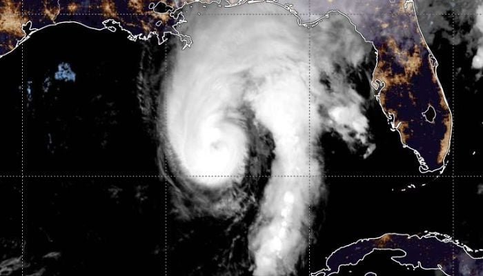
Isaias has intensified to become a hazardous Category 3 hurricane as of Friday and is predicted to make landfall between Mobile Bay, Alabama, and Destin, Florida, Friday night.
As of lunchtime, Isaias was located about 160 miles south of Pensacola with maximum sustained winds of 120 miles per hour and moving toward the north-northeast. It will make landfall between 7 p.m. and 10 p.m. local time, and the worst damage is expected between Pensacola and Panama City.
Residents of the region were busy Friday boarding up their windows, stacking sandbags, and preparing themselves for the hurricane. Thousands of soldiers of the National Guard have been called out. In addition, mandatory evacuation orders have been issued in low-lying coastal regions. Governor of Alabama, Kay Ivey, ordered non-residents to evacuate Gulf Shores, Orange Beach and Dauphin Island.
There are concerns that there may be storm surge of up to 6 to 9 feet high, damaging winds, floods and tornadoes. There is a hurricane warning from Ocean Springs in Mississippi to Mexico Beach in Florida, while a tornado warning has been issued for some regions in the Florida Panhandle, southern Alabama and Georgia until Friday evening. The hurricane is projected to weaken into a tropical storm on Saturday afternoon, although it will bring heavy rainfall of between 4 and 8 inches and up to 15 inches in some isolated areas of southern Alabama, the Florida Panhandle and southwestern Georgia until the weekend.
The storm has affected oil production from the Gulf of Mexico.

